Geomatic support for Natagriwal.
Natagriwal produces expert reports to support the development of agri-environmental measures for farmers. We support their activity by managing their spatial database and by developing cartographic clients to interact with their spatial data.
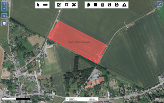
In a first phase, we set up a PostgreSQL/PostGIS database with a QGIS client. In a second phase, we developed in Javascript a dedicated cartographic application that integrates with the expert reports redaction application (in PHP). Compared to the use of a classical GIS software, the cartographic application allowed to simplify the writing of expert reports for Natagriwal’s officers.
[Read More]