Client: Bruxelles Environnement Leefmilieu Brussel
Budget: global 82.000€ HTVA
Réalisation: Partnership Atelier Cartographique / Champs-Libres / APERe
2019 - 2020
Development of a mapping portal of the geothermal potential for Brussels region. Realised for Bruxelles-Environnement, in partnership with APERe (BE) and Atelier Cartographique (BE).
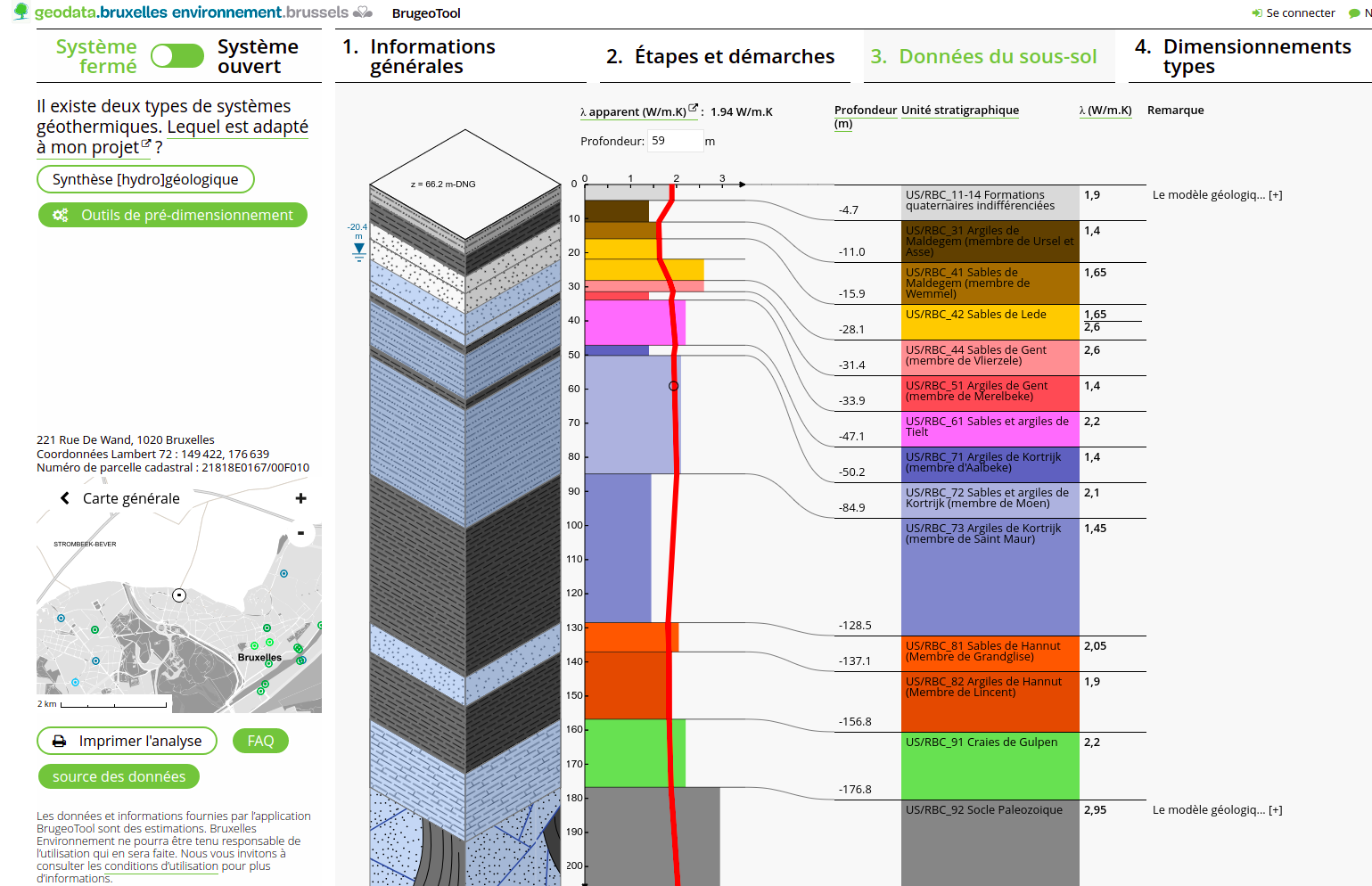
The mission consisted of presenting geological data via an original cartographic interface, combining a classical slippy map to a 3D viewer. At each point of the region at a resolution of 10m, a precise geological profile is automatically extracted when you click on the map. This application is intended for the informed general public and geothermal energy professionals in the Brussels Region. The application is integrated into the Brussels-Environment open source mapping platform.
Technologies utilisées:
Typescript
-
React
-
python
-
PostGIS
-
Django
-
LESS-CSS
-
HTML5