At first sight, street labelling looks like a fairly basic feature in cartography. But finding a way to display the largest possible number of street labels while keeping map readability can become very challenging! In this post, we report about our tests to maximise the presence of street labels in a map produced with Mapnik.
Note: the images in this blog post are intended for a printed map, so they actually looked small at the screen. Right-click and open them in a new tab to see them at a better scale!
How to force labelling
Due to its collision algorithm, Mapnik won’t necessarily display all the street names that exists. However, often, you want to maximise the number of street names that are displayed. Here are some tricks to do so:
Suppose you have a street layer with street names in the field “name”, some basic instructions (in cartoCSS) to render street labels are the following:
text-name:'[name]';
text-face-name: @sans;
text-size: @text_size_s;
where @text_size_s is equal to 35.
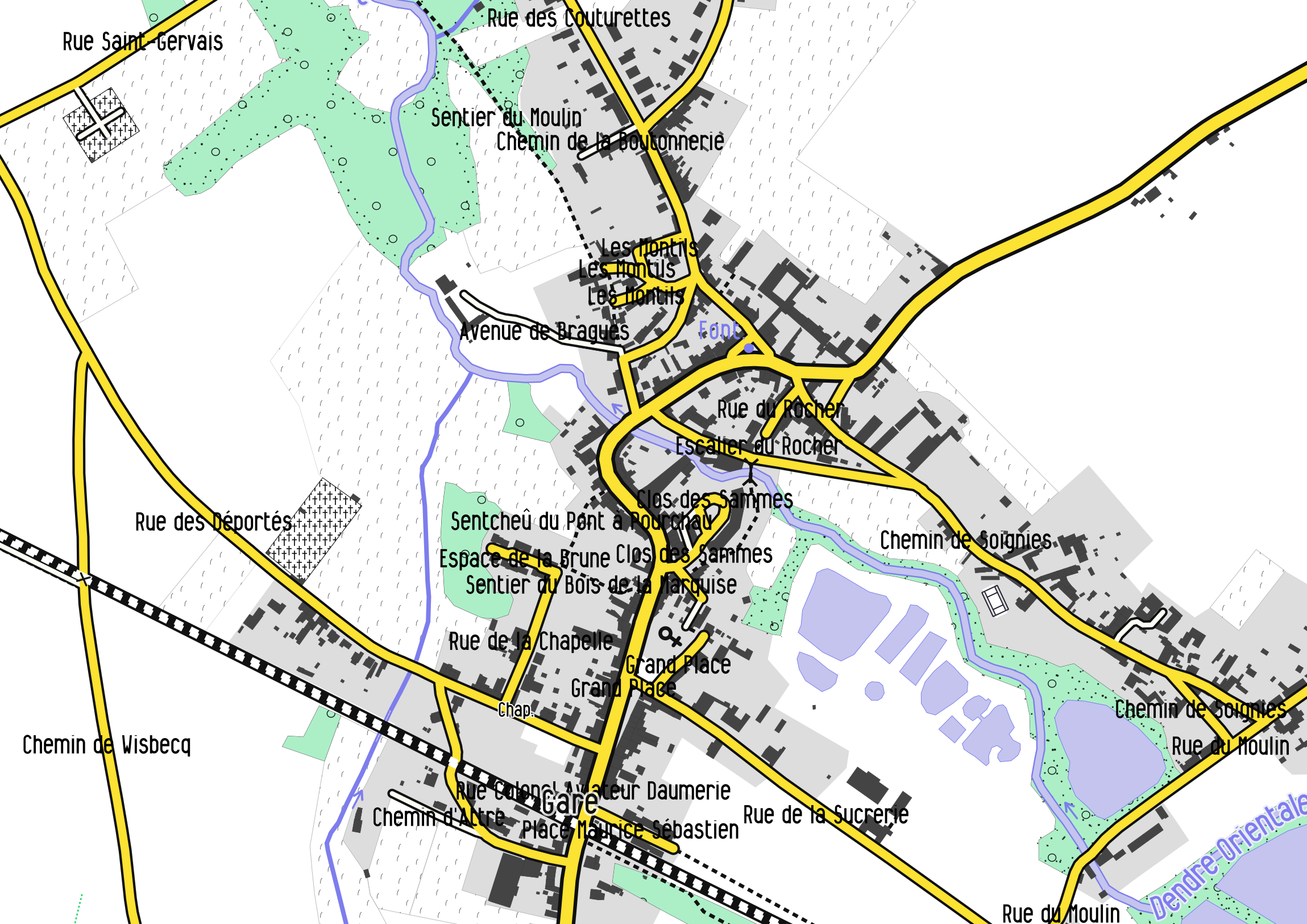
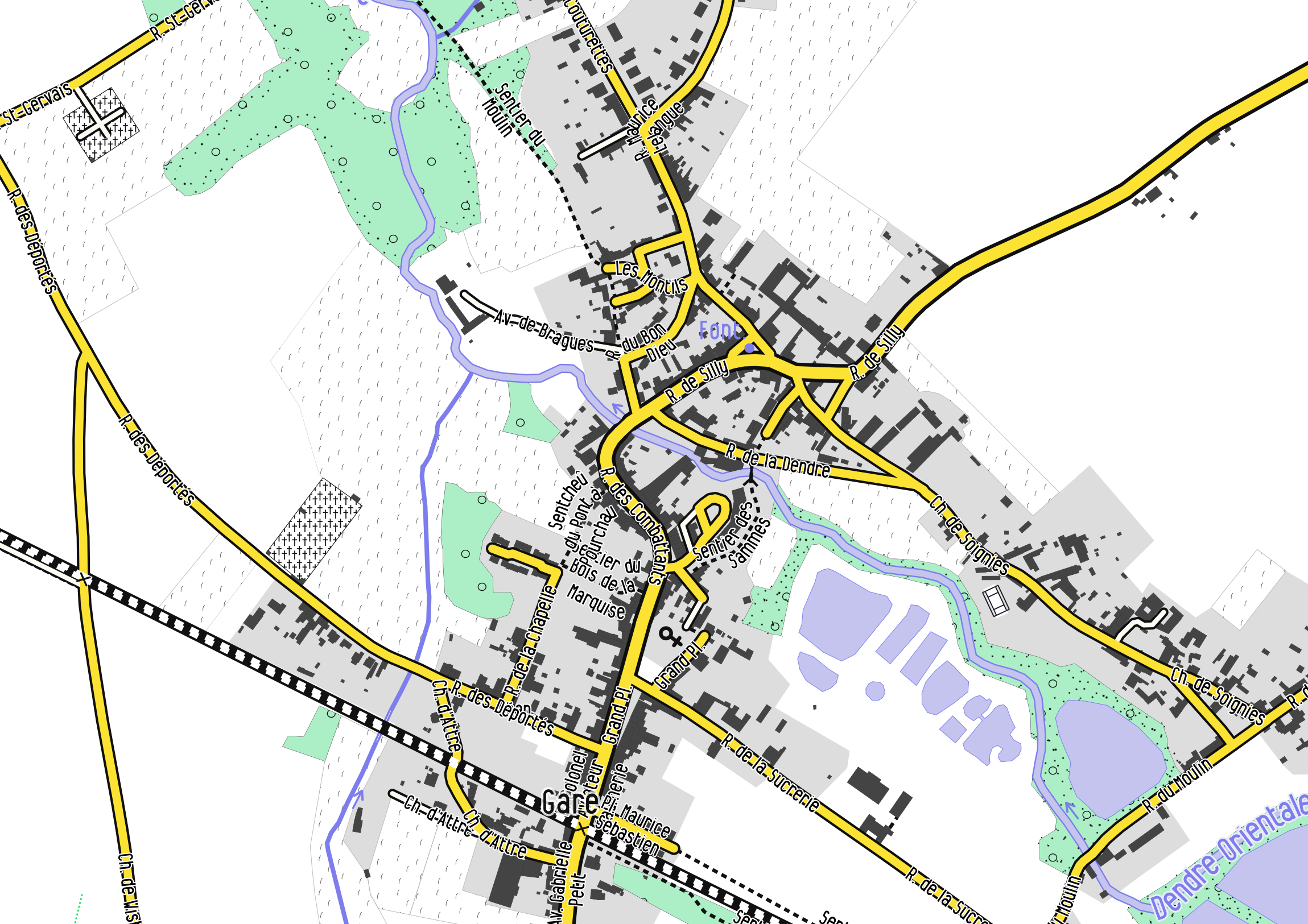
This is not looking really nice. We can tell Mapnik to follow the street lines with text-placement:line; and also put a halo around the street labels.
This looks better, but meanwhile we lost a lot of labels! Let’s see how to get them back.
Decrease the text-size of the label
A very efficient way to display more labels! But obviously, you cannot decrease too much the text size, especially in case of printed paper maps.

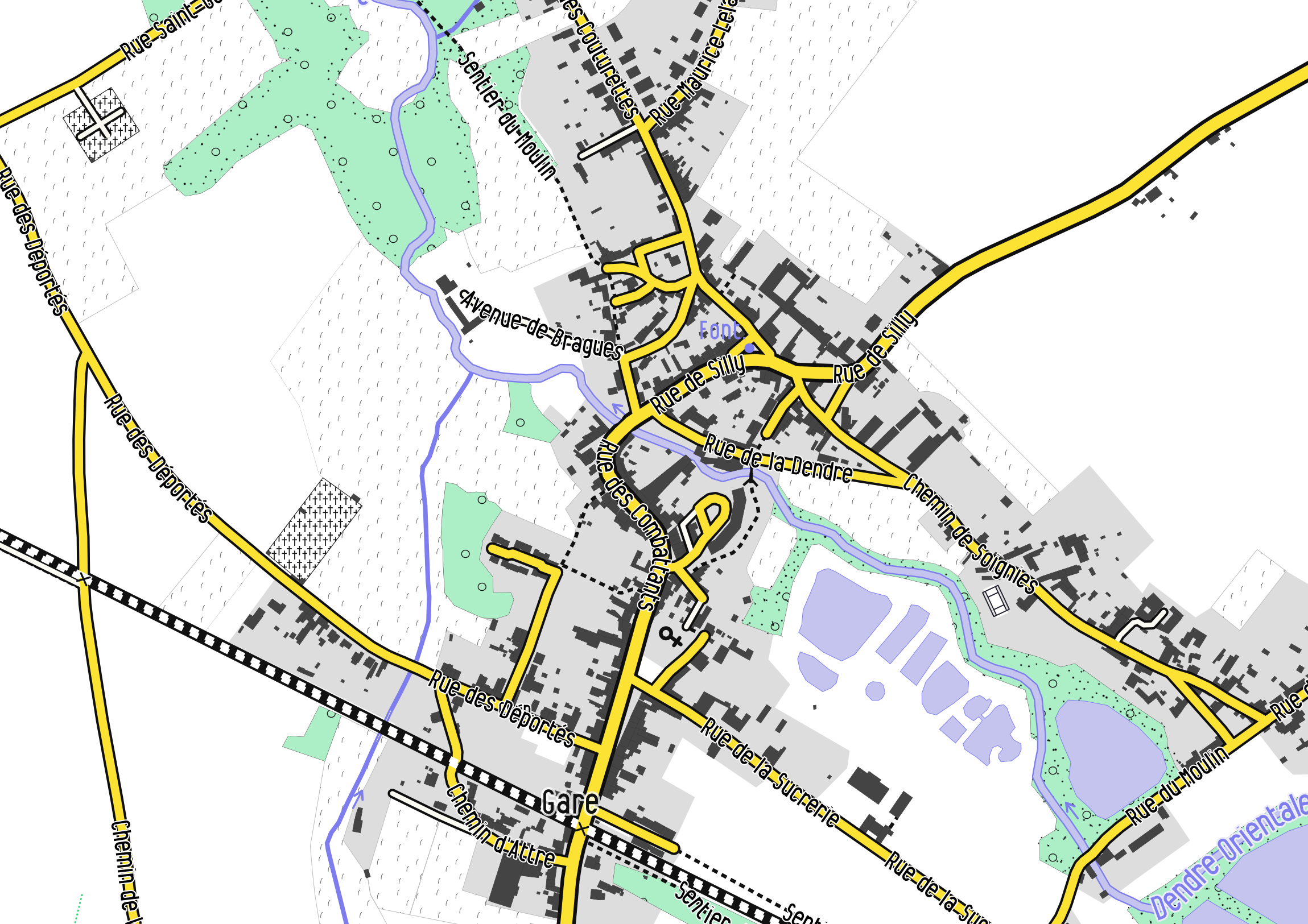
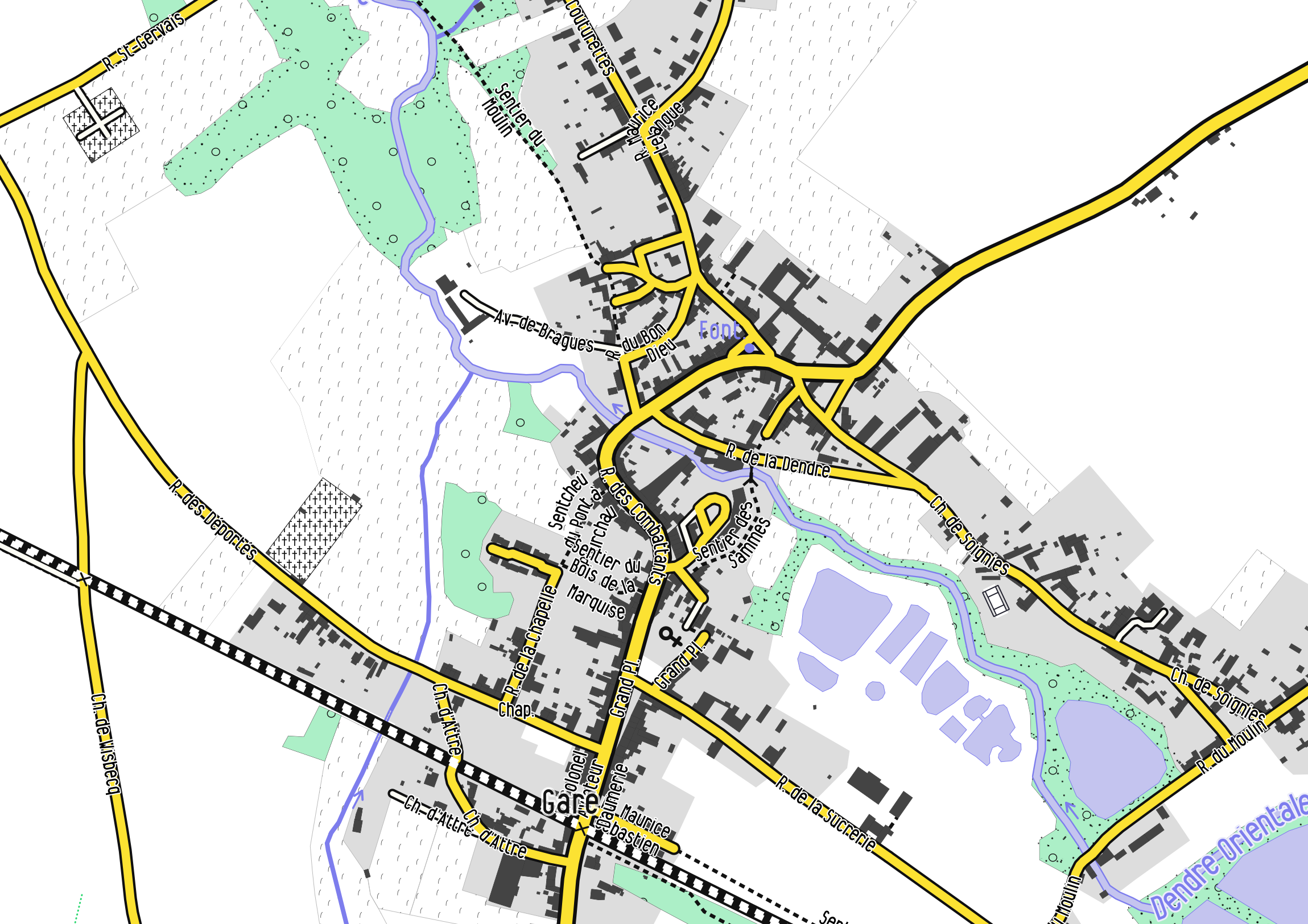
Set text-allow-overlap: true.
By default, Mapnik will avoid to superimpose labels from the same layer. In case of street however, it is reasonable to allow the overlap of labels, as it would cause problems only around crossroads. In our case, we gain one more label.
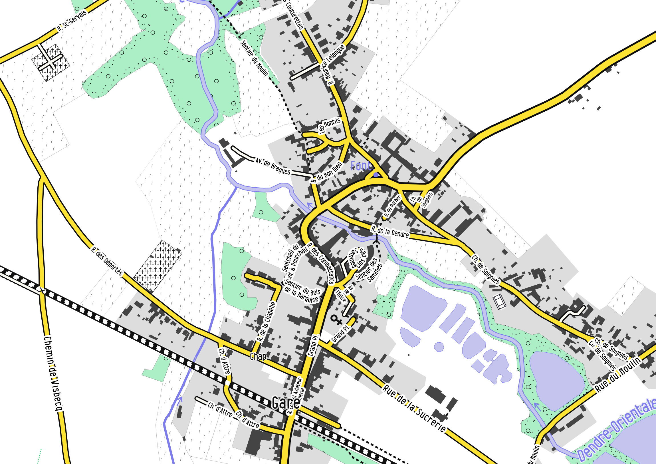
Set “clear-label-cache”: “on” in the project file
Mapnik will also avoid to have collision between labels from the other layers. For disabling this anti-collision effect between layers, text-allow-overlap has no effect. You have to set the parameter “clear-label-cache”:“on” in the project file to the layer. In cartoCSS, this is done by writing this parameter inside the “properties” of the layer in your “project.mml” file (and not in the cartoCSS mss files):
{
"name": "street_label",
"Datasource": { ... },
"properties": { "clear-label-cache": "on" },
...
}
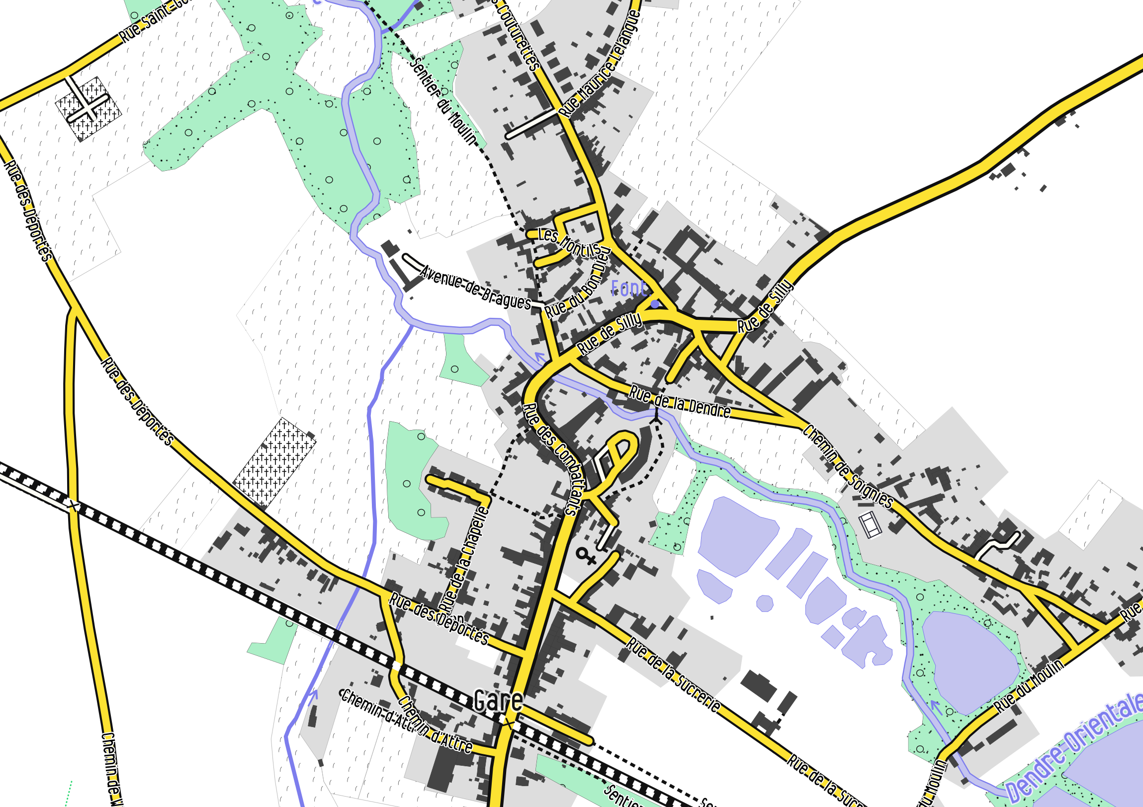
Replace some text by some abbreviations
Quite efficient, since it will decrease the length of yours labels. In Mapnik, this can be done directly in the project file by defining some replacement rules. If you work with a PostGIS database, use some SQL statements with the SQL function replace. To replace several words, the “replace” statements can be nested as follows:
replace(replace(replace(replace(replace(replace(name, 'Rue', 'R.'), 'Saint', 'St'), 'Chemin', 'Ch.'), 'Place', 'Pl.'), 'Avenue', 'Av.'), 'Boulevard', 'Bd.') AS short_name
where we abbreviate here some commons words encountered in French street names. In our case, we did not gain so much labels, but it is more readable and in some cases (or if you use stronger abbreviations, for instance for very long street names), the gain can be considerable.
Wrap the labels
Labels can be wrapped using the text-wrap-width parameter. The smaller the value (in pixels, not the number of letters), the sooner the text will wrap in 2 or more lines.

We gained quite a lot of labels, although this is a little bit less readable.
Increase the maximum angle for curving the Labels
If you have particularly highly-curved streets where Mapnik does not want to print the labels, increase the text-max-char-angle-delta value. It will increase the curvature of the labels which may help in some cases to display more labels! By default, this parameter has a value of 22.5°. Here we increased it to 50°:
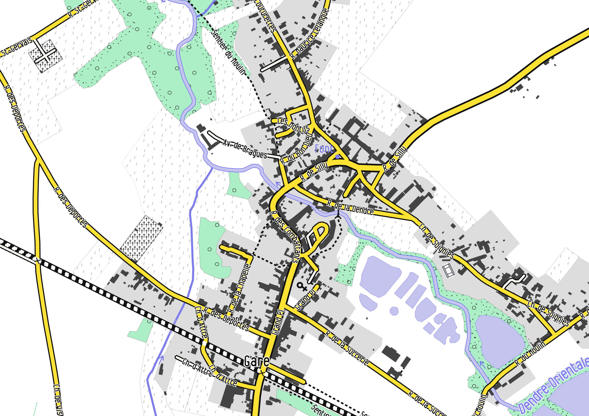
Merge the streets that are adjacents
Often, the street in OSM are split at numerous points for various reasons (because other tags are present, simply because the user digitalize in several segments, ….). In our example, this causes some unwanted repetitions of the street label along the same street (Rue du Moulin, Rue de la Sucrerie, …)
To avoid such repetition of the same label along a split street, we can merge the adjacent segments together after having grouping the street by their name, directly in the SQL query:
SELECT name, ST_LineMerge(ST_Union(way)) AS way, highway
FROM planet_osm_line
WHERE "highway" IS NOT NULL AND "name" IS NOT NULL
GROUP BY name, highway
This last map has “lost” some labels because of the adjacent street merging. If you still want some repetitions of labels, then you can set the text-repeat-distance parameter for repeating the labels and having full control on it.
Mixing the rules
A nice render can be achieved when mixing the above-mentioned properties and especially by setting rules based on the street length.
For instance, the following lines set 5 different street labeling behaviours based on the street length:
#street_label {
  text-name:'[very_short_name]';
  text-face-name: @sans;
  text-size: @text_size_xxs;
  text-placement: line;
  text-halo-fill: #ffffff;
  text-halo-radius: 6;
  text-allow-overlap: true;
  text-max-char-angle-delta: 70;
  [length <= 100] {
    text-name: '[very_short_name]';
    text-wrap-width: 20;
    text-size: @text_size_xxs;
  }
  [length > 100] {
    text-name: '[very_short_name]';
    text-wrap-width: 100;
    text-size: @text_size_xxs;
  }
  [length > 150]{
    text-name: '[short_name]';
    text-wrap-width: 100;
    text-size: @text_size_xs;
  }
  [length > 400]{
    text-name: '[short_name]';
    text-wrap-width: 200;
    text-size: @text_size_xs;
  }
  [length > 1800]{
    text-name: '[name]';
    text-wrap-width: 600;
    text-size: @text_size_s;
    text-repeat-distance: 2000;
    text-character-spacing: 2;
  }
}
where [short_name] is an abbreviated name and [very_short_name] an even more abbreviated name. For smallest streets (<=100 pixels), street names will be abbreviated and wrapped after only 20 pixels. The second and third rules increases the wrapping distance while the last one also increase the text-character-spacing.
Other tips and useful parameters
-
Decrease the
text-character-spacingwill also condense your text labels, and so could help to place more labels. However, the default is already the smallest value. -
Use
text-simplify. You can use this parameter to simplify the geometry that is labeled. It seems it can have a (limited) effect on the label placement: some labels have disappeared and some others appeared when testing this parameter. -
text-repeat-distanceis very useful when making rules based on the length of the street. Put some values (in pixels) to increase the distance between two labels when labels are repeated along a same feature. -
text-label-position-tolerance: The default value will in general maximise the positioning, but smaller values can reduce the number of text labels.
